Brief description of the loop
This 6 km loop walk around the ‘world’s smallest city’ takes in its finest views and the sights of the surrounding area in less than 2 hours.
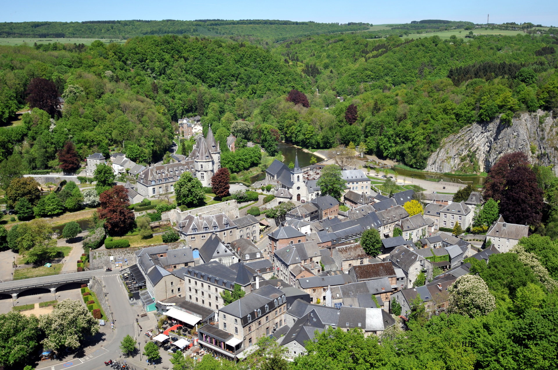
The old city
The city’s name is thought to derive from two Celtic words: dur, meaning oak or wood, and bu, meaning water.
Durbuy therefore describes a place near a river and a wood.
Walking down Rue Jean de Bohême, you go back in history by entering the former branch of the Ourthe which surrounded the old city and its castle until 1725, when the Récollectine sisters carried out drainage work to prevent disastrous flooding.
The anticline was formed by a movement of the earth’s crust which caused it to fold and be lifted upwards. It’s an impressive sight – seemingly surging up from the water with quiet power.
After skirting the stretch of water created to mark the city’s twinning with Hanyu, Japan, in 1995, you arrive at the esplanade by the Ourthe flood wall.
Turn to admire the beautiful view of the Récollectines’ church, the current parish church, and the towers of the castle of the Counts of Ursel.
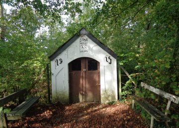
Leave Durbuy on a path that takes you up through the beech trees. Walk quietly: there are lots of birds in the woods here.
If you’re running out of energy, there are three ways of shortening the loop.
The first shortcut through the woods is here, taking you back down to Place de Hanyu via a set of steps, the Escaliers des Béguines.
However, if you follow the waymarkers, you will continue your ascent straight ahead towards a viewpoint, the Panorama des Crêtes, after turning off from the path which climbs to the left. As you come out of the woods, notice the forked beech tree on the left: its shape is reminiscent of a pitchfork brandished by an angry peasant.
Leave Rue du Plâtre by turning right at the Saint-Amour crossroads (the Confiturerie Saint-Amour sells traditional jams and old-fashioned herbal ointments, creams and remedies).
You are now at an altitude of 300 m. From the top of its 75 steps, the Belvédère des Crêtes offers the widest panorama of the region (from Noiseux to Izier, a sweep of approximately 20 km).
Now retrace your steps as far as the waymarker for the Chemin du Belvédère: this is the second shortcut, leading to the Place aux Foires in 10 minutes, and taking in the superb viewpoint that overlooks the old city from a height of several dozen metres. The path takes you along the bed of a ravine and brings you out next to the Cadet Roussel building with its cob walls.
From the belvedere, the walk descends Neuve Voie as far as the hairpin bend.
The Bois de Chapli
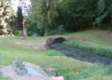
At the top, after open fields and fir trees, the walk leaves the road on the right at the foot of an oak tree. You enter a delightful wood, the Bois de Chapli, with its wonderful variety of wildlife, aromatic scents and birdsong, eventually emerging between fields and pastures in the Ourthe floodplain up-river from Durbuy, opposite the Pré Joris steps which descend to the tourist trail.
Here, the route joins a third, ‘waterside’ variant that is accessible to walkers with reduced mobility. This takes you along the river and past Parc Philippart, with the monumental lime tree with its multiple entwined trunks.
This variant ends in Durbuy in the courtyard of the Ferme au Chêne, before crossing the footbridge over the river to the Topiary Park. After crossing the new footbridge, it then carries on up the left bank for 1 km to Pré Joris.
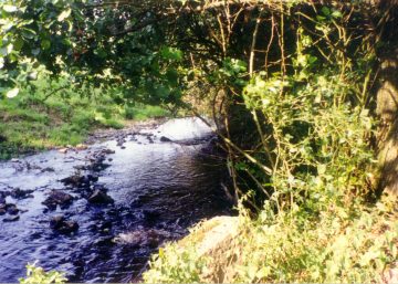
At the entrance to Durbuy, the loop walk follows the river as far as the nicely folded limestone outcrop on which the castle stands.
Practical information
Start: Durbuy (Place aux Foires)
Waymarker: blue rectangle
Distance: 5.5 km
Approximate duration: 2 hours
Level of difficulty: moderate
Distinctive features: forest – open country
Si le fichier s’ouvre directement dans le navigateur :
- sur ordinateur, clic droit + Enregistrer la cible du lien sous.
- sur téléphone, appui long + Télécharger le lien