Brief description
Jenneret is a small village at the edge of Durbuy, and this walk allows you to explore two different regions. You will notice the distinctive geographical and natural features of these two regions, which are so close and yet so different: the Ardennes and the Condroz.
Notes
Jenneret: a special village
Before leaving, take the time to admire this village, which seems to belong to a different age. You will have this sense of having travelled back a generation throughout the walk.
The neo-Romanesque St. Martin’s church was partly rebuilt in 1873. The farms date from the 18th and 19th centuries and are made of limestone rubble. Most of these buildings relate to crop farming rather than livestock farming, although the two are often combined. The soil here in the Condroz is richer than the Ardennes, making crop-growing possible.
The centenary avenue
Leaving the village, you take Drève du Centenaire, an avenue planted with lime trees in 1930 to mark Belgium’s centenary.
Bende: a village at the edge of the municipality
After you have walked along this avenue, you come to the little village of Bende, most of whose houses are made of limestone. It’s well worth having a look round. Perched on a crest, it offers a full view of the Condroz.
A little geography
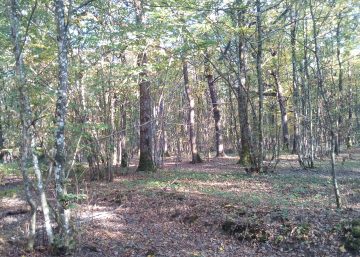
The relief of the Condroz is exceptionally regular. Lines of valleys are succeeded by parallel lines of hills, like a huge roller-coaster.
The crests are covered with woods which descend the slopes that catch the wet, cold north-west winds. In the chavées (troughs), the limestone has decomposed to leave a clay deposit; more and more of this land is being used for farming today.
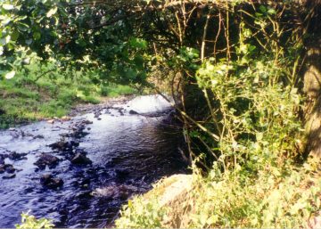
You will next cross a little stream, the Néblon, which rises in Ocquier and flows into the Ourthe at Hamoir.
Notice the change of scenery shortly before you return to Jenneret, with woodlands (especially when away to the south) replacing the open country you could see a little while ago.
Practical information
Start: Jenneret (church)
Waymarker: green diamond
Distance: 12 km
Approximate duration: 4 hours
Level of difficulty: moderate
Distinctive features: forest – open country
Si le fichier s’ouvre directement dans le navigateur :
- sur ordinateur, clic droit + Enregistrer la cible du lien sous.
- sur téléphone, appui long + Télécharger le lien