Brief description
This medieval-themed walk leads to the plateau of Rahiermont (Mont-St-Rahy), rich in history, with an atmosphere steeped in the religious practices of our ancestors. At the end of the walk, you can discover the archaeological treasures of the Grotte du Coléoptère.
Notes
The start of the walk takes you in the direction of Petit-Bomal and its fortified farmhouse, where the route leaves the road to take a stony path.
Le Mont Saint Rahy
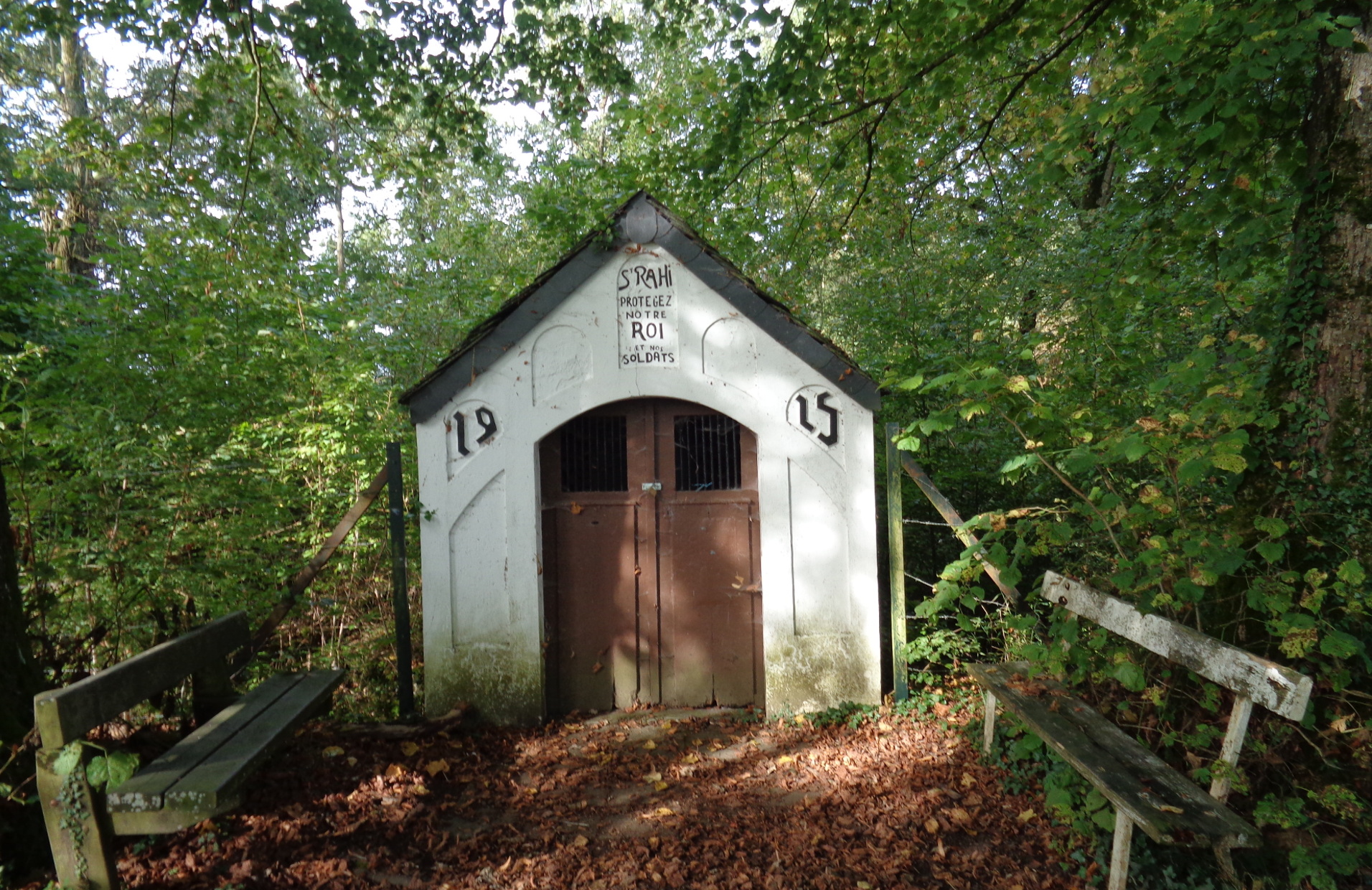
Mont-Saint-Rahy is mentioned in many accounts as an abandoned village. As early as 1852, the following notice appears: ‘In the territory of Bomal are found the ruins of an ancient village called Saint-Rahy, whose church, presbytery and other buildings can still be discerned.’
This village, which had as many as 26 houses, probably disappeared due to an epidemic. Its inhabitants abandoned it in the late 16th century. The story of this epidemic may originate in a legend about the disappearance of the statue of Saint-Rahy: numerous people died, but the epidemic ended immediately when the statue was restored to its position.
From this plateau, you skirt some crop fields and arrive at the village of Ozo, known mainly for its goat farm, which you pass by. The village is worth stopping in for a while.
You then descend to the village of Juzaine, overlooked by a Frasnian limestone cliff known as Li Rotche-al-Pâplaine, on top of which stands the Tombeux cross.
The Grotte du Coléoptère
At the foot of this cliff, a beautiful entrance porch leads into a cave, the Grotte du Coléoptère. The cave is of no particular interest to speleologists, but in archaeological terms it is an important monument to the prehistory of Belgium. The first harpoon from the Magdalenian era (in which the use of bone tools and pictorial art flourished) was brought to light here on 5 June 1923. Shortly afterwards, researchers from the University of Liège discovered a curious object that gave the cave its name. Crafted from incised and polished mammoth ivory, this unique piece has one flat and one rounded side. The excavators believed that the object represented a beetle; the cave’s name means ‘Beetle Cave’ in French.
The park of Bomal castle
After you have climbed and then carried on past the belvedere, take time to have a good look at the red-brick Bomal castle dating from 1774, next to the old church (restored in the 19th century) whose cemetery contains a tomb from 1537.
practical information
Start: Bomal, Place du Sassin
Waymarker: green diamond
Distance: 11.5 km
Approximate duration: 4 hours
Level of difficulty: difficult
Si le fichier s’ouvre directement dans le navigateur :
- sur ordinateur, clic droit + Enregistrer la cible du lien sous.
- sur téléphone, appui long + Télécharger le lien


